The best UK route planner isn’t Komoot or Strava—it’s the rider who understands the unique « digital DNA » of both platforms to unlock hidden roads.
- Komoot excels at unearthing true hidden gems by leveraging detailed OpenStreetMap layers, surface type data, and community-vetted « Highlights ».
- Strava’s strength lies in its Heatmaps, revealing proven, popular routes, but this can create a « popularity bias » that steers you away from truly quiet lanes.
Recommendation: Use Komoot for creative exploration and discovering new territory; use Strava to vet a route’s popularity, analyse climbing segments, and see where the cycling community is actually riding.
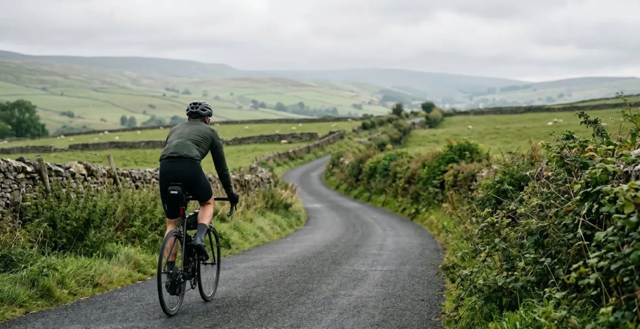
Every cyclist knows the feeling. You’re tired of your local loop, the same familiar tarmac, the same predictable traffic lights. You crave discovery, the thrill of a quiet, winding B-road you’ve never seen before, a hidden bridleway that opens up a new vista. The promise of digital route planners like Komoot and Strava is that they can be your key to this world. The debate then inevitably begins in every cafe and on every forum: which one is better?
The standard answer is simple: Strava is for performance and competition, Komoot is for adventure and exploration. While true on the surface, this misses the deeper point. It treats the apps like vending machines where you press a button and a route comes out. But for the true route-planning artist, the cyclist hunting for those genuine hidden gems across the UK’s varied landscape, the secret isn’t choosing one app over the other. It’s about understanding how each one *thinks*. It’s about learning their digital DNA to make them work for you.
This guide moves beyond the surface-level comparison. We will dissect the underlying data, philosophies, and unique features of both Komoot and Strava from the perspective of a UK rider. We’ll explore why one is better for Welsh valleys and the other for Scottish Highland epics, and how to combine their strengths to become a master of your own routes, painting your perfect ride line onto the map.
This detailed analysis breaks down the specific scenarios every UK cyclist faces, from losing signal in the hills to interpreting steep gradients and finding legally rideable paths. Here is a summary of the key areas we’ll explore to help you master your route planning.
Summary: A Deep Dive into UK Route Planning
- No Signal in the Valleys: Why Offline Maps Are Essential for Welsh Adventures
- The « Re-Routing » Loop: How to Recover When Your GPS Sends You Down a Farm Track
- Reading the Spikes: How to Spot a 20% Gradient Before You Are Halfway Up It
- GPX vs. TCX: How to Send the Route to Your Mates Without File Errors?
- Screen Off: How to Make Your GPS Last for a 12-Hour Audax?
- OS Maps vs. Google: Why You Shouldn’t Trust Your Phone on Rural Greenways
- Beyond the Trail Centre: How to Find Legal Bridleways Worth Riding in the UK?
- Credit Card or Camping: Defining Your Bikepacking Style for the First Trip
No Signal in the Valleys: Why Offline Maps Are Essential for Welsh Adventures
There’s nothing more liberating than cresting a hill in the Brecon Beacons or dropping into a remote valley in Snowdonia, only to find your phone has zero bars. In these moments, your route planner’s reliance on a mobile signal becomes its greatest weakness. This is where the fundamental difference in offline capabilities becomes a critical safety and exploration feature. For any serious UK explorer, offline functionality is non-negotiable.
Komoot is built from the ground up with this reality in mind. By allowing you to purchase and download entire regions for offline use, it ensures that its turn-by-turn voice navigation and detailed maps work flawlessly, regardless of your phone’s connection. You can buy a single region for a weekend trip or unlock the whole world for epic tours. The ability to navigate confidently without a data connection is the first step in becoming a true route artist, free from the constraints of network coverage.
This isn’t just a convenience; it’s an essential tool endorsed by local authorities. As the Snowdonia National Park Authority points out for its own dedicated app, the value is clear.
It works off-line, so no internet or phone signal is required when using the app on the mountain.
– Snowdonia National Park Authority, Snowdon Walks App Official Guide
While Strava has made strides in its offline capabilities, its core function remains tethered to a live connection for many features, making Komoot the clear winner for anyone venturing into the UK’s beautiful but often signal-poor landscapes. This independence is the foundation of genuine exploration.
The « Re-Routing » Loop: How to Recover When Your GPS Sends You Down a Farm Track
It’s a rite of passage for any UK cyclist: your GPS confidently declares « Turn left, » and you find yourself facing not a road, but a muddy, rutted farm track disappearing into a field. This is the moment where the app’s algorithm clashes with reality. While both Komoot and Strava offer « re-routing » features, the mindset of the route artist is not to blindly follow the next instruction, but to understand the landscape and make an informed, creative choice.
This is where you, the rider, take control back from the machine. Instead of panicking, see it as an opportunity. Is that farm track a dead end, or an unmapped bridleway that could be a glorious discovery? Zoom out on your device. Look at the contour lines. Is there a way to loop back to your intended route via another lane? The best recovery tool is your own judgement, augmented by the map data at your fingertips.
The key is to use the GPS not as a dictator, but as a consultant. Komoot’s detailed map, with its clear delineation of different path types, is invaluable here. You can often see if that « farm track » is marked as a public byway or a private road. Strava’s Heatmap, on the other hand, can tell you if any other cyclists have ever been brave (or foolish) enough to venture down that path. A faint blue line might suggest a viable, if challenging, alternative. Recovering from a bad turn isn’t a technical failure; it’s an interactive part of the route creation process.
Reading the Spikes: How to Spot a 20% Gradient Before You Are Halfway Up It
The UK’s topography is defined by its short, viciously steep climbs. A ride in the Peak District, the Yorkshire Dales, or Devon isn’t measured in long alpine ascents, but in walls of tarmac that suddenly appear after a blind corner. Being able to read a route’s elevation profile is crucial for both pacing and enjoyment. Here, the « digital DNA » of Komoot and Strava offers two very different, but equally valid, ways of seeing the road ahead.
Komoot provides the raw, unfiltered truth. It displays a detailed gradient profile that shows you every lump and bump. Its topographical map layers allow you to see the contour lines getting closer together, a clear visual warning of an impending steep section. This is the cartographer’s view: you are given the raw data to interpret for yourself. You can see the exact shape of the climb before you get there.
Strava, with its history in performance and competition, takes a different approach. It contextualises climbs through its community-defined Segments. That 20% wall of pain isn’t just a spike on a graph; it’s « Hardknott Pass, » a Cat 1 climb with a leaderboard. This is the racer’s view: the climb is defined by the human effort that has been spent on it. It provides social proof of a climb’s difficulty.
As BikeRadar’s testing revealed, this difference in philosophy is key. Komoot lets you identify the challenge by reading the map, while Strava tells you what the challenge is called based on community consensus.
Case Study: Interpreting UK Climbs
2024 testing revealed that both apps handle UK’s characteristic short, steep climbs differently. Komoot displays contour lines on topographical layers allowing riders to visually identify tight elevation changes on the map itself, while Strava leverages its segment database where climbs like Hardknott Pass are pre-categorized by the community, providing human-verified difficulty indicators rather than relying solely on algorithmic gradient calculations.
The table below, based on a recent comparative analysis, highlights these fundamental differences in approach.
| Feature | Komoot | Strava |
|---|---|---|
| Primary Focus | Route discovery and exploration | Performance tracking and competition |
| Elevation Profile Detail | Raw gradient profile with detailed topographical data | Segment data with categorized climbs (Cat 4, 3, etc.) |
| Surface Type Information | Detailed surface layering (singletrack, cobbles, unpaved sections) | Limited surface information |
| Map Data Source | OpenStreetMap with enhanced cycling-specific layers | OpenStreetMap with Mapbox terrain mapping |
| Community Features | Highlights with photos and local recommendations | Heatmaps showing popular routes and segment leaderboards |
| Offline Navigation | Full turn-by-turn voice navigation offline | Limited offline support |
GPX vs. TCX: How to Send the Route to Your Mates Without File Errors?
You’ve crafted the perfect route, a masterpiece of quiet lanes and scenic views. Now you need to share it with your riding group. This seemingly simple step can be a surprising source of frustration, with file errors, incompatible formats, and friends whose devices show a straight line instead of your beautiful route. Understanding the difference between file formats like GPX and TCX is a crucial part of the route artist’s technical toolkit.
A GPX (GPS Exchange Format) file is essentially a series of points, like a breadcrumb trail. A TCX (Training Center XML) file is richer, containing not just the route but also turn-by-turn navigation cues. While many believe GPX is the universal standard, technical documentation from route-planning specialists shows that TCX files are the most widely used format across most modern GPS cycling devices for full navigation features.
The choice matters. Sending a GPX file to someone with a Garmin Edge might just give them a line to follow on a map, whereas a TCX file would provide them with « Turn Left in 100m » prompts. Conversely, some devices like Wahoo’s ELEMNT series work best with a specific type of GPX file (a ‘GPX Track’). The key is not to just hit ‘Export,’ but to export with intent, considering the devices your friends will be using.
Your Action Plan: The Definitive File-Sharing Checklist
- Identify Device Compatibility: TCX files work best with Garmin Edge devices for turn-by-turn navigation, while GPX Track files are recommended for Wahoo ELEMNT units.
- Choose Based on Data Needs: Use TCX Course format if you need turn-by-turn navigation data and advanced turn notifications. Use GPX Track if your group only needs the route line to follow.
- Export Correctly: When exporting from Komoot or Strava, always select ‘GPX Track’ (not ‘GPX Route’) to avoid file corruption, especially for complex routes like those on the Sustrans National Cycle Network.
- Verify File Integrity: Check that the file name contains no special characters, trim any unnecessary start/end points, and confirm the file format matches your recipients’ device requirements before sending.
- Test Before Sharing: The golden rule—import the exported file back into your own app or device to verify it displays correctly before sending it to your entire riding group.
Screen Off: How to Make Your GPS Last for a 12-Hour Audax?
For the long-distance rider, the Audax enthusiast, or anyone planning a ride that lasts from dawn until dusk, battery life is not a feature—it’s everything. A dead GPS unit 150km into a 200km ride is more than an inconvenience; it’s a potential ride-ender. The biggest culprit of battery drain is the screen. Therefore, the ability to navigate effectively with the screen off is the holy grail of endurance cycling tech.
This is another area where Komoot’s exploration-focused design gives it a distinct advantage. Its turn-by-turn voice navigation is designed to work seamlessly offline and with the phone’s screen locked. You receive clear audio cues for upcoming junctions and turns, allowing you to keep your phone in your pocket, conserving precious battery life for the entire 12-hour event. As any long-distance cyclist knows, « Offline maps and GPS uses a lot of battery. »
Strava, while offering route following, generally requires the screen to be active or at least more frequently consulted for navigation prompts, leading to significantly faster battery drain. For a short, punchy 2-hour blast, this is irrelevant. For an all-day epic, it’s a critical flaw.
Case Study: Battery Efficiency on Long Rides
A recent analysis found that using screen-off audio cues for navigation can significantly extend battery life during long Audax events. Komoot’s turn-by-turn voice navigation works offline and can guide riders through unmarked B-road junctions without requiring constant screen illumination, while Strava’s route planner requires users to keep the app active for navigation prompts, resulting in faster battery drain during 12+ hour rides.
The savvy route artist chooses their tool based on the canvas. For the sprawling canvas of an Audax, a tool that prioritises endurance over constant visual feedback is the only logical choice.
OS Maps vs. Google: Why You Shouldn’t Trust Your Phone on Rural Greenways
The map on your screen looks simple, but underneath it is a complex tapestry of data from various sources. And not all sources are created equal, especially when you leave the city behind. Many riders assume that the maps on their cycling apps are as reliable as Google Maps, but this is a dangerous assumption on the UK’s rural greenways and byways.
The digital cartography of most cycling apps, including Strava and Komoot, is built on the foundation of OpenStreetMap (OSM), a community-driven, open-source mapping project. This is a huge strength, as OSM often contains details about cycle paths, bridleways, and trails that are completely absent from Google’s road-centric database. However, it’s not infallible. As Condor Cycles notes, this reliance on OSM has its own quirks.
Strava uses OpenStreetMap, rather than Google, as well as terrain mapping from Mapbox, which means some cycle paths and byways aren’t always shown.
– Condor Cycles, What is the best way to plan a new ride
This is why a route planner’s own « flavour » is so important. Komoot heavily enhances its OSM base map with its own data layers for surface type, difficulty, and community-sourced photos, giving you a much richer picture. Strava overlays its Heatmap, showing you where people *actually ride*, which can be a powerful validator. The route artist understands that no single map tells the whole story. They learn to cross-reference the digital line with the physical world.
Never blindly trust a single digital source. The real world has muddy sections, overgrown paths, and locked gates that don’t appear on any map. Use the app as your primary guide, but keep your eyes open and be prepared to trust a weathered wooden signpost over a pixelated line on a screen.
Beyond the Trail Centre: How to Find Legal Bridleways Worth Riding in the UK?
For many riders, exploring off-road means heading to a trail centre. But the UK is criss-crossed by thousands of miles of public rights of way, including bridleways and byways that are legally accessible by bike. Finding these is the first step; finding the ones that are actually *worth riding* is the real art. This is where Komoot’s community-driven approach offers a significant edge over Strava’s performance-focused platform.
The official Definitive Map shows you what’s legal, but it won’t tell you if a bridleway is a beautiful gravel track or an impassable boggy mess overgrown with nettles. This is a critical distinction for anyone looking to escape the tarmac. Official statistics from Cycling UK highlight just how important our quieter network is; analysis shows that most cycle mileage in Great Britain happens on minor roads, with only 17-19% occurring on A roads. The appetite for quiet routes is huge.
This is where crowdsourced intelligence becomes invaluable. Strava’s Heatmap can show you if a bridleway is popular, which is a good indicator of its rideability. However, it offers little context. Komoot, on the other hand, allows users to create « Highlights »—specific points of interest with photos and comments. You can see recent pictures of a trail’s condition, read comments about tricky sections, and discover scenic spots you’d never find on a map alone.
Case Study: Vetting Bridleways with Community Data
Komoot’s Community Highlights feature allows UK cyclists to vet potential bridleways through user-uploaded photos and recent comments. This crowdsourced intelligence helps identify whether a legally-rideable bridleway is actually practical—revealing issues like overgrown vegetation, boggy conditions, or fallen trees that wouldn’t appear on the Definitive Map. This provides crucial real-world conditions data that is impossible to obtain on Strava’s more performance-focused platform.
Using this feature is like having a nationwide network of fellow explorers scouting the trails for you, turning the abstract lines on a map into a reliable, real-world guide.
Key takeaways
- The ‘best’ app is a myth; the skilled rider uses both Komoot’s deep exploration features and Strava’s community-proven routes.
- Komoot’s strength lies in its detailed OSM layers, surface type data, and offline capabilities, making it ideal for true discovery.
- Strava’s Heatmaps and Segments provide invaluable social proof of a route’s popularity and a climb’s difficulty, but can bias you towards busier roads.
Credit Card or Camping: Defining Your Bikepacking Style for the First Trip
The ultimate expression of route-planning artistry is bikepacking. Whether it’s a « credit card tour » hopping between B&Bs in the Cotswolds or a self-supported wild camping trip in the Scottish Highlands, the route is the narrative of your adventure. The choice between Komoot and Strava here becomes less about features and more about the kind of story you want to tell.
If your style is lightweight and flexible, relying on pubs for lunch and hotels for the night, Komoot is your perfect companion. Its map is rich with Points of Interest (POIs). As Cycling Labs notes, « Komoot, with its POIs for hotels, pubs, and campsites, is ideal for ‘credit card’ touring. » You can plan a route that explicitly links these points of civilisation, ensuring you’re never far from a warm meal or a comfortable bed.
If, however, your adventure is about minimalism and covering ground on proven paths, Strava’s Heatmap offers a different kind of reassurance. On a multi-day trip through the Highlands, you don’t want to be experimenting with unknown tracks. You want the confidence that comes from following a path that thousands of other riders have successfully navigated. The Heatmap provides this, showing the most-travelled arteries through remote landscapes.
A June 2026 review of bikepacking route planning highlighted these distinct advantages. For planning a journey through the populated Cotswolds, Komoot’s POI database was unmatched. For identifying the most reliable and tested paths through the vast and empty Scottish Highlands, Strava’s Heatmap was the essential tool. Your choice of app should directly reflect your bikepacking philosophy.
Ultimately, the debate is not about a victor. It’s about vision. Stop asking « Komoot or Strava? » and start asking, « What kind of route artist do I want to be? » Do you want to be the explorer, uncovering forgotten lanes with Komoot’s detailed maps? Or the pioneer, following the collective wisdom of the community on Strava’s heat-scorched paths? The truly great artist learns to use both, blending discovery with validation to create a ride that is uniquely their own.